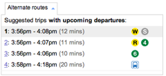
When I saw this morning on Google Maps that New York City’s Subway system was finally part of Google Transit, I got mighty curious: What’s Metro doing to work on this? So, I asked WMATA’s Lisa Farbstein what was going on. Metro’s response, via Lisa, was “We have been working with Google, however a formal agreement has yet to be finalized.”
It would be so delightful if I could point people at Google Maps to do the routing, as anyone who’s ever used the Metro Public Transit Mapping Tool would know. C’mon Metro, if New York can do it, we can too, yeah?


VRE said they are also working with Google
For the iPhone, the site http://www.meenster.com gives times for the next train. It’s not perfect, but it fits the bill.
Yeah, it’s not awful, but I’d love to point people at Google for good point to point directions for getting around town on public transit.